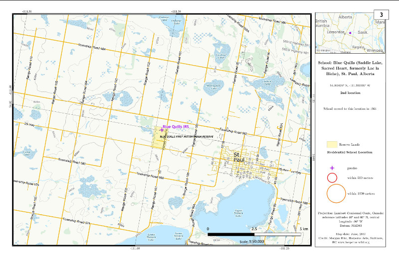
This
is
one of the most interesting yet disturbing projects that
I've done.
I was hired in the spring of 2017 to map the 140 Indian
Residential
Schools and their surrounding Reserves. These schools are a
notorious
part of Canadian history, and these maps were for the Justice
For Day Scholars initiative.
Imagine
my
surprise when I found out there was no geographic data for
these
schools. That's right. Despite the research efforts of the
Truth and
Reconciliation Comission, there was no list of
latitude/longitude data
for the schools, no pre-existing maps of their actual
locations.
On the other hand, there were several online maps that
located the
schools. One was at the National Centre for
Truth and Reconciliation (NCTR),
one at Carleton
University, and one at a
site called Eugenics
Archive.
However, none offered their geographic data for download. As
well,
the three sites disagreed among themselves about the
locations of a
number of schools, and since none of them made their
evidence,
references, or chain of reasoning available to the visitor,
it was not
possible to decide which was right.
So, I set out to do this research myself. Using survey maps
at the Canada Lands
Survey System I found primary source maps that located
sixty-two
of the schools. There were other archival documents that led
me to be
able to locate another sixty-eight schools. Thirty-four of
the schools I was never able
to locate precisely, but had evidence that allowed me to
determine their position within a kilometre.
Those numbers add up to 164 locations. This is because many
of the 140
schools moved, sometimes more than once.
You can download the data I created, in LibreOffice Calc
format, here, and in KML (Google Earth) format here.
It includes references! However, there are a few caveats:
-
Better
data, based in part on my research, is now
(2017-2018) being produced
through a collaboration between NCTR and York
University. My hope is
that it will eventually be posted on the web in a
download-able format,
along with references for each location.
-
I
was hired to map only the 140 schools listed in
the Indian Residential
Schools Settlement Agreement. These are only the
schools that the
federal government funded and therefore was
willing to take
responsibility for. My data does not include any
of the three following
categories.
-
Schools
that were funded in some other way, such as
through privately-raised church funds
-
Day
schools that never built a residence and
thereby made the transition to being
residential schools
-
Schools
in Newfoundland and Labrador, which were not
included in the settlement
-
I
did not thoroughly research the dates that each
school operated. There
is much conflicting information about these
dates, and sometimes dates
given reflect only the years that a school was
government-funded. I did
not attempt to resolve these issues.
- The
field called "Location precision distance (km)"
(abbreviated to
"location p" in the KML file) is an expression of
how precise the
location is. A zero value here means I feel
confident that the school
is right there; a 0.5 or 1 value means the school
was not percisely
locatable, but must be within 0.5 or 1 km of the
location given.
If you are interested in the complete 201-page atlas of
residential schools, with
maps of each location at 1:50,000, feel free to drop me an
email
at morgan_at_hesperus-wild.org, and I can send you a PDF.
The projection was
Lambert Conformal Conic, centred on 96° west, with
standard parallels of 20° and 60° north, lat_0 = 40.

