 |
|
Upper
Fraser Fisheries Conservation Alliance
|
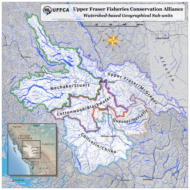 |
The Upper Fraser Fisheries Conservation Alliance works for the conservation and sustainable harvest of fish by its member communities, which are the Upper Fraser First Nations. This map, which is meant to show the sub-units of the organization, uses QGIS's inverted polygons styling to create a semi-transparent grey mask around the UFFCA area. Scale is 1:750,000. It uses the Atlas of Canada 1:1,000,000 scale national framework data for water features, and the provincial WMS hillshade (315°). The inset map (1:7,500,000) uses Tom Patterson's Natural Earth data, particularly the cross-blended hypsometric tints. |