 |
|
Twin
Falls Recreation Site, Smithers, BC
|
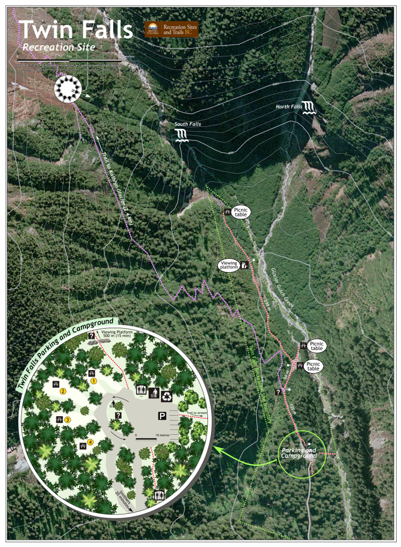 |
Twin Falls is the premier outdoor site to which Smithers visitors are taken, so it was an honour to be asked by Recreation Sites and Trails BC to prepare a new map for it. The map is 22 x 30", and therefore at the extremely large scale of 1:1,375. Fortunately good quality aerial photography was available in the form of the BC government's 2006 Natural Colour UTM 9 WMS service (https://openmaps.gov.bc.ca/lzt/ows). I displayed it at the bottom of the stack with -44 brightness and +47 saturation. It gives a nice sense of the depth of the site in its narrow canyon. The contour lines were generated from a 0.75" DEM downloaded from the Canada.ca Geospatial Data Extraction site. They are a bit oversized (0.3 mm and 0.8 mm thick) and a purply-grey (#bfbecf) so that they show up nicely over this saturated image. The Parking and Campground inset was constructed in Inkscape using SVG tree symbols from landscape architecture. I wanted to capture the heavy feeling of this wet forest where the sun rarely shines and cedar trees are side-by-side with giant spruces. The site lies in a narrow canyon running roughly east–west, with walls rising up to 800 metres on either side, so getting a good GPS signal in here is more or less impossible. I walked around quite a few times, measured things by pacing them out, and took photographs so that I could re-construct details later. I was there in early November, shortly before snow closed the road in. The maps features a north arrow/compass rose based on a twelve-pointed star. It sounds like it shouldn't work (compass roses are usually 16-pointed) but it's actually quite effective. A second map was also prepared, at 1:3,500, to show the greater area and the complete route to the glacier. |
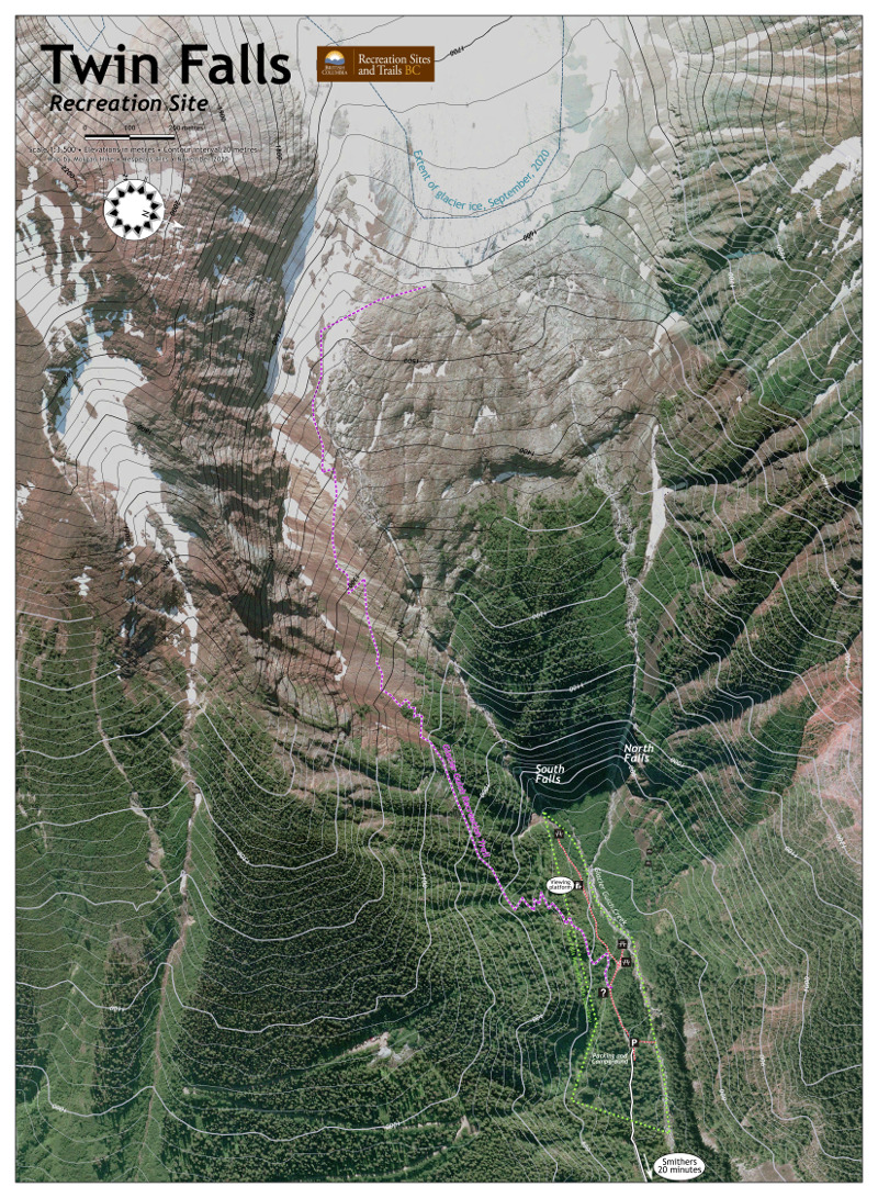 |
The aerial photo shows the glacier extent in 2006, but I was able to obtain the actual present glacier extent from a Sentinel-2 image taken in September 2020. It has retreated about 150 metres in those fourteen years. Grey contours lines were not going to work over the glacier, so I digitized a mask for the ice-and-rock area, and clipped the contours against it. These contours are displayed in black. |