 |
|
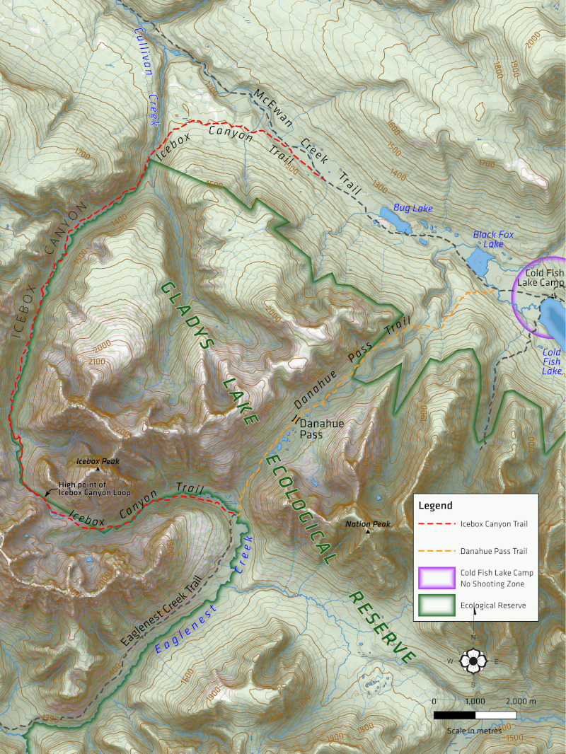
Spatisizi
Park Trailhead Signage
|
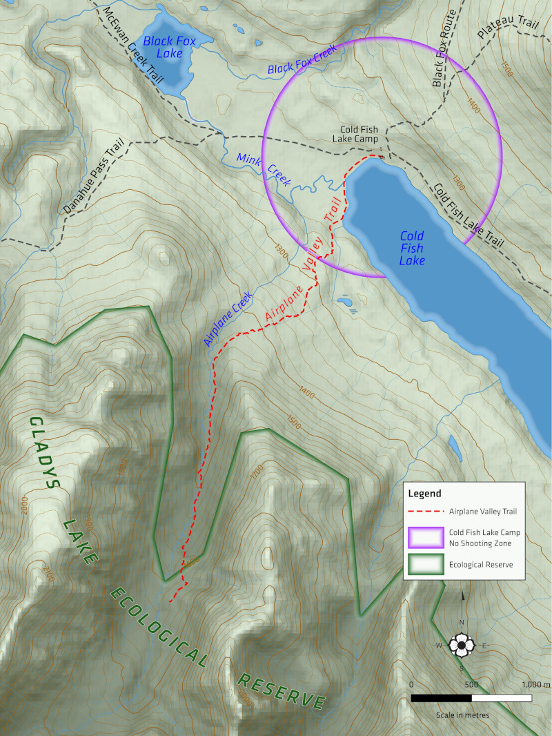 |
Most visitors enter Spatsizi Provincial Park by flying into Coldfish Lake. BC Parks has signage for a number of trails that radiate from the Coldfish Lake Camp: the Airplane Valley trail (shown above), the Black Fox route, the Icebox Canyon loop (shown below) and the Plateau Trail. The trailhead signs themselves are 16" x 24" but only a portion of that is the map, so I made these for 9" x 12". The scales varied from 1:12,500 to 1:60,000, so I used 1:20,000 scale data. Actually, the only data I needed (BC Parks sent me KMZ files for the trails) was water features, whcih come from teh Freshwater Atlas of BC. The rest is just shaded relief and the "wooded area" layer from the CanVec 1:50,000 scale BC Land dataset. |
 |
Shaded relief is SRTM 1" data (30m) and a 50/50 blend of the "Overcast" and "Type 13" Skymodels. As well, each map was accompanied by a trail profile for the featured trail. I produced these in QGIS using the Profile plugin, exported as SVG and then touched up in Inkscape. 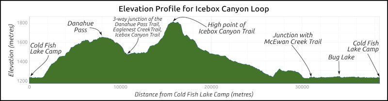 |