|
|
Sheltered
Waters mapping, Northwest Territories
|
|
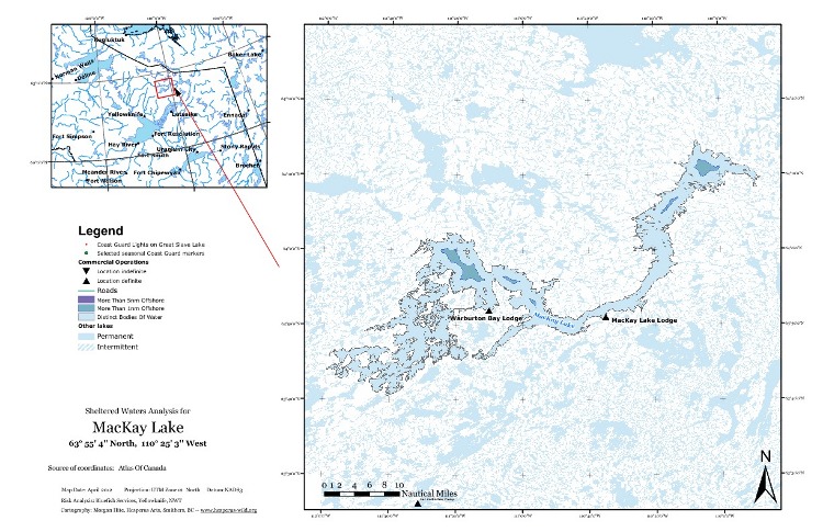
This project was undertaken for Bluefish Services of Yellowknife, NWT. In brief, the goal was to support the consideration of some lakes in the Northwest Territories as sheltered waters by mapping the areas more than 1km and 5km offshore. There were twenty-nine lakes, plus eleven bodies of water that were portions of either Great Slave Lake or Great Bear Lake. Each one needed a map page, so I needed some automated way to generate them. I settled on ArcMap and its MapBook function. (QGIS's Atlas plugin almost did the trick, but could not provide an overview map that would change with each page.) In order to keep north at the top of each map, I separated the lakes by UTM zone and generated a MapBook for each zone. To get an idea of how large the NWT is, consider that the bodies of water I was mapping fell across zones 9, 10, 11, 12 and 13. We determined that the 1:50,000 CanVec data for the lakes was the best. I spent a good period of time downloading 168 quads of this data. Merging them together into a single lakes layer was quite easy. I simply set Ubuntu to searching through the entire data tree for HD_148.*. This returns all the lakes files. I make an empty copy of one of them, and then execute an ogr2ogr script to merge them together. It takes less than a minute. (It takes longer to copy all the files to my laptop than it does to merge them.) The result I store on the laptop (and a copy on the virtual Windows machine I'm running ArcMap on) for fast access. I created 1nm and 5nm buffers within the bodies of water that were of interest using QGIS. Most lakes had to be assembled by merging into a single polygon the many pieces that fell in different CanVec quads. Then each lake would be reprojected into a projection using metres (I used UTM). At this point it could be buffered at -1852m, which is one nautical mile. Some lakes however were so big (e.g., Dubawnt Lake had 100,000 vertices) that I had to simplify them first using ArcMap's "Simplify (Polygon)" tool. The smallest body of water was 1nm long; the largest over 30nm. There was no way to make the scale bar work for all the maps. If I set the scale bar interval to 5nm, giant lakes like Dubawnt had such a small scale bar that it was illegible; with tiny lakes like Grace, the scale bar was so large it broke through the map frame. So I divided the lakes into four groups, based on how large the scale bar should be, and the intervals for graticule labels around the outside of the frame. In the end I had to produce 11 different MapBooks, each with a unique combination of UTZ zone and scale. Buffering subsections of Great Slave and Great Bear lakes provided another challenge. A specific line across a bay or arm defined the area of interest, but the key was to first cut out more than you need. Add an extra few nautical miles say 5 km. You can buffer this to get the >1nm and >5nm zones. Then in the second round, cut out just the area of interest, and clip the >1nm and >5nm zones to it.
|