 |
|
Shared
Histories
|
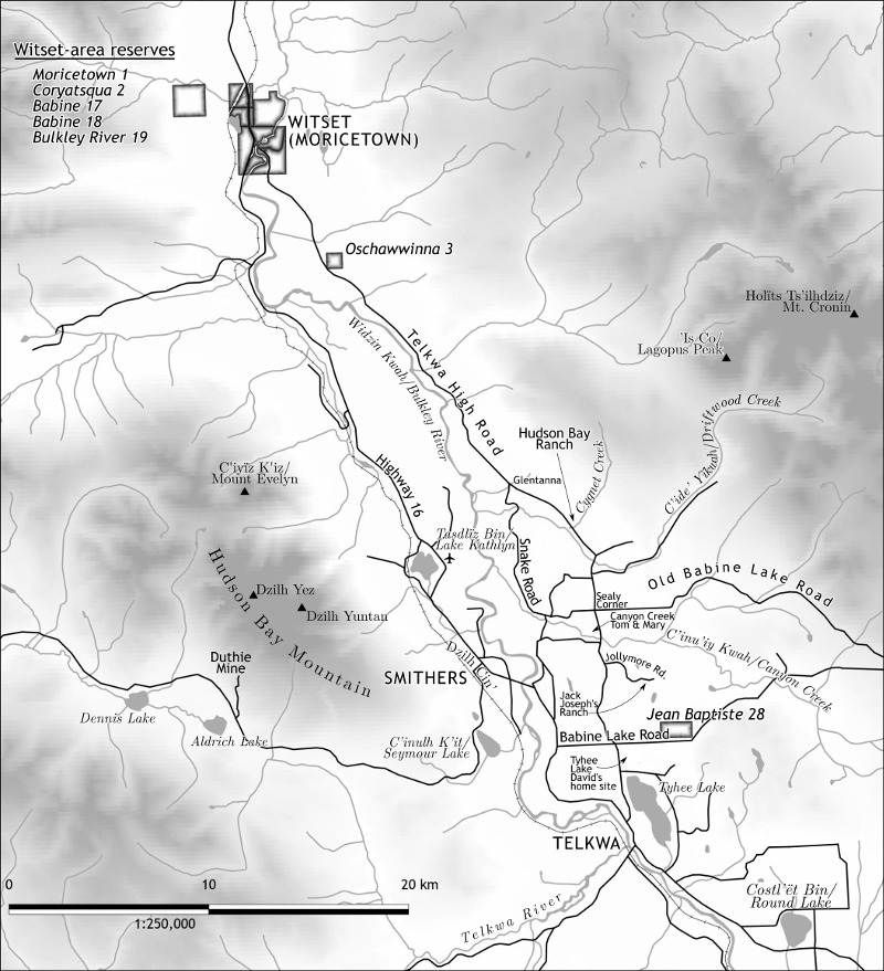 |
In 2018 Creekstone Press released Tyler McCreary's Shared Histories, an account of indigenous-settler relations in and around Smithers. I did four maps for the book. The one above was the third in a series that began with all of northern BC from Prince Rupert to Prince George, and the last of which focused just on the town of Smithers itself. I chose to do some hypsographic shading rather than shaded relief. The scale was 1:250,000, so the DEM I used was SRTM resampled to 10" cells. I appreciated that for this map I, in many cases, got to put Wet'suwet'en names first, followed by the gazetted name. |
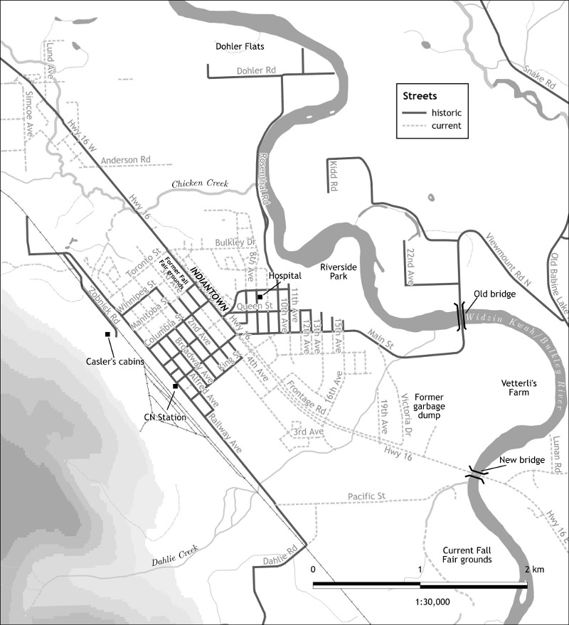 |
For the Smithers map, I determined the roads from a 1947 air photograph featured in the book. |