 |
|
Crossing
the Divide, by Wayne Sawchuk
|
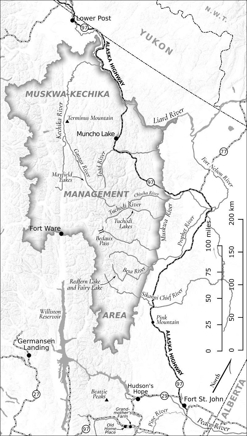 |
I did three maps for Wayne Sawchuk's autobiography, Crossing the Divide: Discovering a Wilderness Ethic in Canada’s Northern Rockies, published by Creekstone Press in 2020. Much of his story centres around the Muskwa-Kechika Management Area in northeastern British Columbia, the largest protected wilderness area in the Rocky Mountains. The map shown above was at 1:3,500,000 in UTM zone 12, and it was necessary to rotate it 20° to fit in all of the places that needed to be shown. The chief goal was clarity around the many important rivers on the one hand, and the highway network connecting settlements on the other. The shaded relief was generated from 15 sec GMTED2010 digital elevation model, using the GDAL hillshading tool (gdaldem) and the "combined shading" switch. It was then added to the map as the bottom layer, and displayed as a singleband greyscale with +39 brightness and -13 contrast. |