 |
|
Sandur
Motocross Area trail map
|
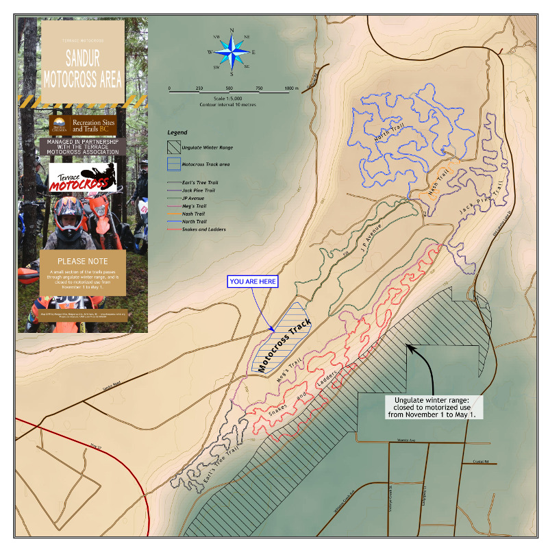 |
There is a motocross area near the Terrace airport called Sandur; this will be the map at the entrance. The key features are the trails themselves and the ungulate winter range. Roads also play a large role (being the digital road atlas layer from the province). I cleaned up (deleted) many unclassified roads on private land to give it a cleaner look. It's quite a large scale map (1:5000), The colour is hypsographic, but it's not a single colour ramp. It is in fact two semi-transparent copies of the DEM layer (CDED 0.75"). One is styled with a ramp that goes green-white-brown and the other is styled with a ramp of red-orange-white. The second DEM adds some warmth to the first one. |