 |
|
Bull
Trout Redd mapping
|
 |
|
The Columbia River has multiple dams on it in BC, and the Hugh Keenleyside, Mica and Revelstoke dams create the extended body of water now known as the Arrow Lakes Reservoir. Bull trout (Salvelinus confluentus) are the dominant piscivorous (fish-eating!) salmonid in the Arrow Lakes Reservoir (ALR), with a recent estimated population of 7,500 catchable-sized fish. When the dams were constructed (from 1969 to 1984), the lower reaches of tributary streams of the Columbia were flooded and the original bull trout spawning grounds were lost. However, they appear to adapted to spawn now in streams flowing into the reservoir. The question remains though about the relative contribution of the various spawning tributaries. For this report,
prepared by fisheries biologist John Hagen, there were ten
figures like the one shown above. I used a plugin in QGIS called "Atlas" which generates a series of PNG map images, one for each object in a specific map layer. You construct the print composer you want to use, and it scales and pans it to each object in turn, and pumps out a series of PNG images. My reference layer in this case was a set of rectangles showing the footprints of each reach of a river or creek for which there was data. Some streams ran north-south and others east-west, so I built two print composers (one portrait, one landscape), and then ran Atlas in two batches. Stream,
river, and lake data was from BC's Freshwater Atlas,
downloadable free at the BC's Land
and Resource Data Warehouse. 100 m contours were
generated from 250K DEM data using GDAL tools in QGIS.
(Download DEM files from GeoBase.) Projection is UTM Zone 11N (NAD83).
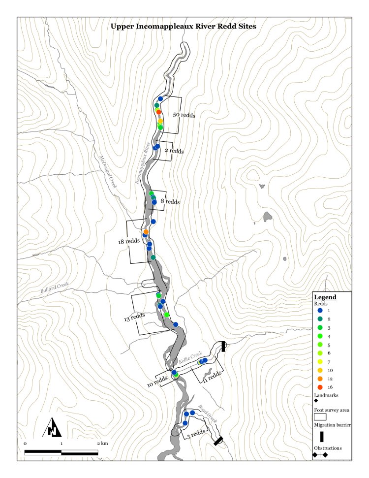
Over the years, the
maps have evolved. Ground surveys for redds now look like
this: |
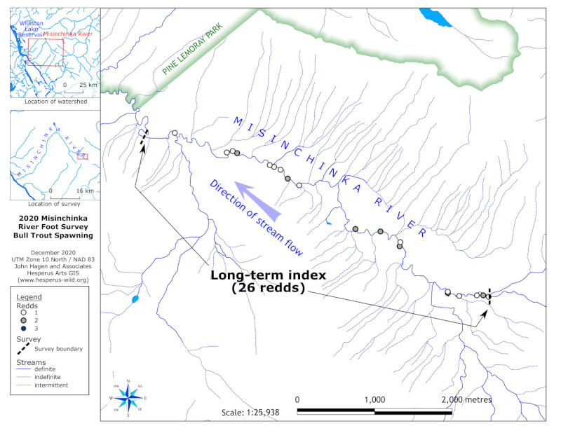 |
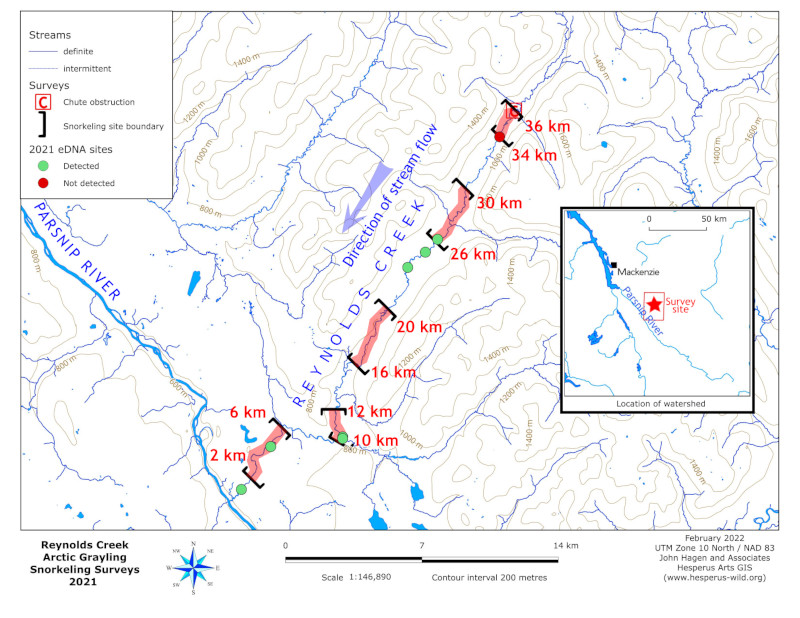
|
And there are now also snorkeling surveys!
|
 |