 |
|
The
Nass Area
|
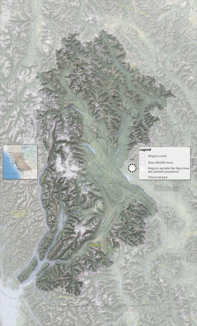 |
BC Parks requested a map of the Nass Area (which is more or less the Nass River watershed in northwest BC). This colossal seven-foot-tall tall map was to be exhibited at the Nisga'a Memorial Lava Bed Provincial Park (Anhluut’ukwsim Laxmihl Angwinga’asanskwhl Nisga’a) in the Nisga'a Territories near New Ayansh. My part was to make the basemap; Double Dare Design of Vancouver would then turn this into a complete exhibit. With this in mind, I delivered the map to them in layers output by Inkscape, and, as shown above, I just randomly stuck the inset map and legend right in the middle, ready to be moved wherever they sat best in the final design. The goal was to give the audience—characterized as not particularly experienced with maps—a sense of the larger landscape into which the park is set. This map was not going to be used for navigation! I conceived of it being as visually 3D as possible, using shaded relief and realistic landcover colours. Due to the extreme size of the map (52" wide, 86" tall), the scale was merely 1:157,000, so I used 1:250,000 scale CanVec data. However, the design team felt that my map would only need to be produced at 100 dpi—perhaps people don't look at a map this large very closely—so in the end the pixel dimensions were only 5200 x 8600. The font of choice was Klavika. |
 |
The map was produced in QGIS and Inkscape. Place names were based on the CanVec 1:50,000 Toponymy layer. The landcover was the NALCMS (North American Land Change Monitoring System) 30m raster dataset, styled to their suggested colours. Shaded relief was done using SRTM 1" data (30m) and a 50/50 blend of the "Overcast" and "Type 13" Skymodels. I greyed out the area outside the Nass Area using the "inverted polygons" feature of QGIS. |