 |
|
Mapping
for A Change In Direction
|
|
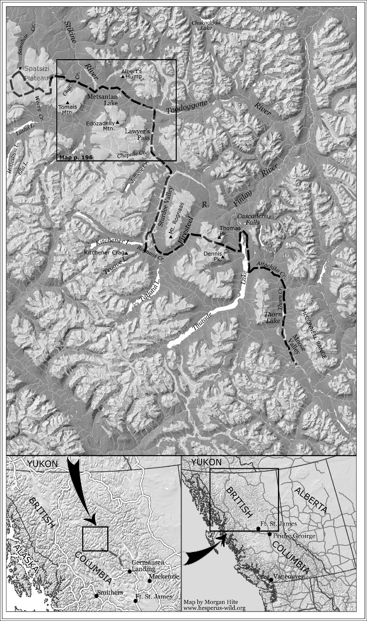
In the first printing of her book, A Change In Direction, Joyce Helweg used a map that was a photograph of the route drawn on the two 1:250K topo maps: 094E (Toodogone River) and 094D (McConnell Creek). Even though those maps were just what you would want in the real world, they were impossible to read when reduced to 4.5"x5" in the book. You could see "Skeena Mountains" and "Finlay Forest" but that was about all. For the second printing, I volunteered to design a map that fit the book. I copied her route by digitizing over a mosaic of those original 1:250K topos in QGIS, and double-checked it by reading the text. I then removed the topos, and for background used the 315° hillshade from the GeoBC WMS. Rivers and lakes came from NRCan's 1:250K National Topographic Database (NTDB). The map was exported from a QGIS print composer as a PNG image, and then read into Inkscape. It was important to show treeline, because the alpine areas and open areas in the valley bottoms figure in the book. I made a special version of the map in QGIS with only the vegetation area layers for those two maps from the NTDB (e.g., 094E_vegetat_a.shp). The vegetated area was displayed in solid black. In Inkscape I layered this PNG over the main map using 23.6% transparency and a blend mode of normal. The result was that in the valley bottoms the topography was obscured, while above treeline all the details of the hillshade were visible. Labels were added in Inkscape: I made a list of all the places named in the book, and made sure those were included. The inset maps had to locate Fort St. James in the context of British Columbia (and Western Canada), but also show where the story takes place, and how one would get to Moose Valley from Fort St. James. |
