 |
|
Bulklkey
River Recreation Site
|
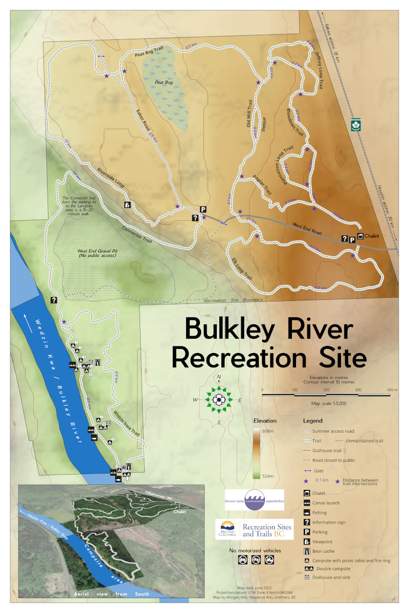 |
The Bulkley River Recreation Site contains aspen-forest lowlands along the river—but reached by an old dirt road that winds down off the bluff, the "Connector Trail." This map is 16" x 24", so the scale is about 1:3500, which poses a challenge for the contour lines and the shaded relief. LiDAR would be the ideal DEM for an area this small, but I did not have LiDAR. As you can imagine, the initial contours I generated from SRTM 1 were a bit jagged! I used Dražen Tutic's great QGIS plugin, Cartographic Line Generalization, to smooth them to 1:40,000 scale so they look reasonable. You'll notice there are two legends: "Legend" and "Elevation." I separated these because when you generate a legend in QGIS and you include a raster elevation layer, it does not produce the large, satisfying colour bar that you want. I worked around this by creating a separate legend for the DEM, and make the symbol height quite big. The little 3D view in the lower left is courtesy of the 3D view features in QGIS. It's just an image from Bing's Satellite layer draped over the DEM. It works pretty well. |