 |
||
 |
||
 |
||
|
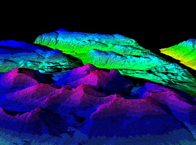
The NTDB (National Topographic Database) is a multi-layered vector dataset. In this example, I used only the hypsography layer. With the GRASS tool v.to.rast I changed the vector layer into a raster layer that showed the contour lines, with random colours assigned to each line, and whitespace between contour lines. Using r.surf.contour I then made a DEM (digital elevation model) raster layer in which cell colours were assigned by interpolation between the contours. Using r.slope.aspect I made two more raster layers in which cell values were associated with slope and aspect. And I made an IHS raster layer using r.his, i.group and i.composite. The DEM raster layer gave the hue values and the aspect raster layer gave the intensity values in the resulting map. Finally I displayed the IHS layer draped over the DEM using d.3d. In this view, you are at 7000' looking northeast across the Ark Mountain quadrangle. Kusawa Lake is the black "water" in the rightmost valley. |
||