 |
|
Appalachian
Trail maps
|
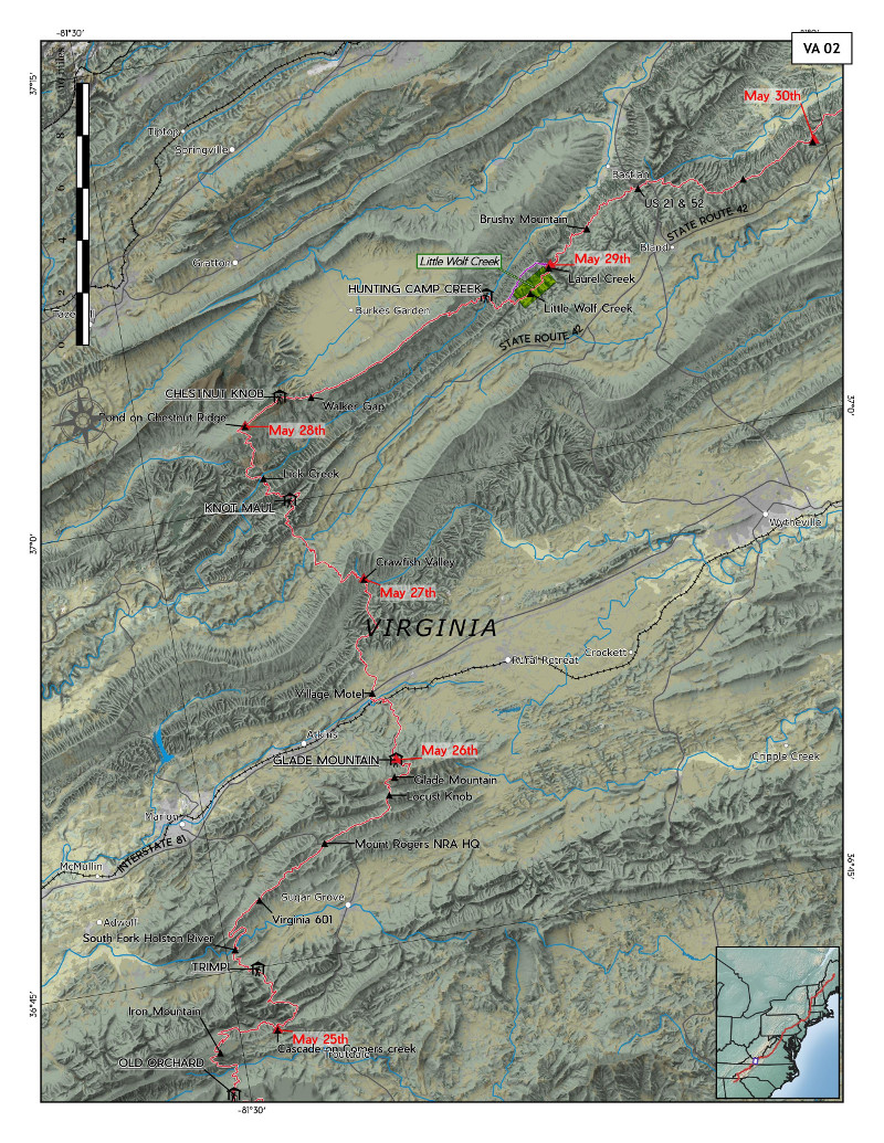 |
It turns out that the Appalachian Trail of 1982 was somewhat different from the Appalachian Trail of today, many relocations having occurred in the long, patient project of getting the trail fully located on public lands. In 1982 I hiked the entire trail, and that year the route through the eastern United States from Springer Mountain in Georgia to Mount Katahdin in Maine was, if I recall correctly, 2120 miles long. My journey took five and half months. So,recently, in the process of mapping where I travelled and where I camped each night, it was necessary to reconstruct, from old guidebooks and maps, just where the 1982 trail went. For the most part it is still the route followed by the trail today, but almost every state has sections that have been moved in the last 39 years. On these maps I have marked the present-day trail in purple wherever it differs from the 1982 trail. |
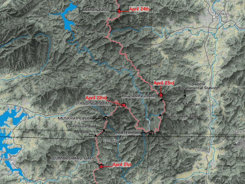 |
The trail transits many different types of terrain, from the intensely complex mountains of western North Carolina, shown above, to the long, thin ridge mountains of Pennsylvania, shown below. |
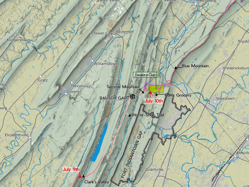 |
Each of these maps is at 1:250,000 scale, and it took a series of thirty-one letter-sized maps to cover the entire trail. They are generated out of QGIS with the "atlas" feature, but because the trail spans three different UTM zones (17, 18 and 19) it was necessary to generate them in three sets, each with its own projection. Landcover here is from the 2010 edition of the U.S. 30-metre NALCMS (North American Land Change Monitoring System) Landcover, displayed with saturation turned down by -40. Shaded relief is based on the NED (National Elevation Dataset) 1' DEMs. I chose a set of these for each UTM zone, merged them and then ran them through Raster Chunk Processing to make my two favourite skymodel hillshades: Type 13 and overcast. They were both given +40 brightness and combined with the Multiply blend mode. Towns, roads, and water features were all taken from the National Atlas 1:1,000,000 datasets. These appear to no longer be available, but something similar is here. Each map has a unique rotation, to accommodate the wandering trail. These vary from 310° through north (360° = 0°) to 20°, and the atlas handles this by setting the rotation of each map from a data field. |