 |
|
Northwestern
British Columbia Wall Map
|
 |
When I first moved to Smithers
I was working for the National Outdoor Leadership School, and we
were able to buy excellent large-format wall maps of British
Columbia. If I remember correctly, six sheets covered the
province (each sheet was about three by four feet), and you
could mosaic these together on the wall. They were excellent for
planning scouting trips and dreaming up ideas of where our
courses could go.
So when I was contacted by an
agent of a hunting lodge in Terrace, BC, who was looking for a
wall map five feet wide and four feet tall of the northwest part
of the province, I immediately thought of these old maps. But as
far as I can tell they are no longer sold, and in fact they'd
would be considerably out of date now. (Although very little
changes in this corner of the world, even in 30 years.)
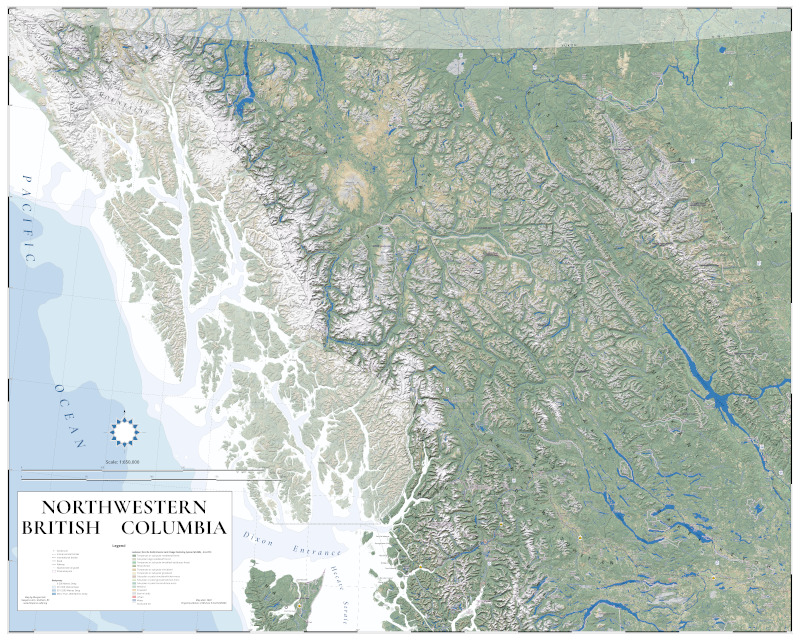
So I set about making a new map
of northwestern BC. This is basically a landscape-based map,
showing highways, settlements and parks. The scale is 1:650,000,
and it is indeed 60 inches wide by 48 inches tall.
|
 |
The vast majority of the work on this map was labelling. I'm pretty sure that on the maps we used in the 90s they had "mapped out" the Indigenous people (meaning, left them off the map), and I didn't want to repeat that. For each nation or language group I placed expanse-labels near the hearts of the tradiitonal territories. Where I was unfamiliar with these, I took them from Native-Land.ca, and I am certainly open to any corrections. I thought maybe I should choose a more sophisticated font than Open Sans, but after looking at a few alternatives I stayed with Open Sans. It has so many variants: semibold, etc. And it looks good. |
 |
As with a
number of my other recent maps, the landcover was the NALCMS
(North American Land Change Monitoring System)
30m raster dataset, styled to their suggested colours.
The
elevation data is SRTM 3. Experienced GIS people will
immediately realize, though, the headache represented by
this map extending slightly into Yukon and the Northwest
Territories: SRTM data doesn't go there. Yes, north of 60° I
used eleven 250K quads of the CDED 1" resolution data,
available at the Geospatial
Data Extraction site. I resampled it to 3" and then
merged it with the SRTM data.
The shaded
relief was a 50/50 blend of the "Overcast" and "Type 13" Skymodels.
|
 |
Here are a few of the
editorial decisions I made on this map:
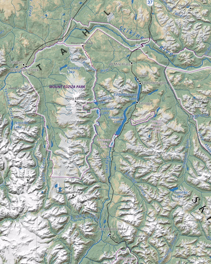
Something that was a little
unusual for me was that I showed parks as shapeburst fill that
was white, rather than green, and I accentuated the white with
a thin purple line around the outside. Park labels then echo
this, being white with a thin purple halo. This works well
against the saturated background.
|
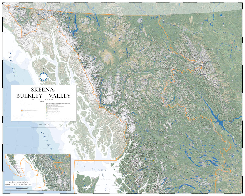 |
Finally, as shown above, I made a second version of this map for our Member of Parliament, Taylor Bachrach, who saw its potential to portray the entire electoral district he represents. This required an inset in the
lower left to accommodate the rest of this enormous riding,
which stretches from just above the northern tip of Vancouver
Island, to the Yukon border. I wonder whether any other riding
in Canada shares such a long land border with a foreign
country.
|