 |
|
Hankin-Evelyn
Backcountry Recreation Area Map
|
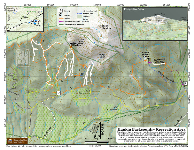 |
This rather unusual backcountry skin-up-and-ski-down area nerar Smithers needed a map that could be printed on ordinary letter-sized paper. Ski runs and uptracks were all provided to me as GPS tracks, and the background data was CanVec. The DEM I pushed to 3 metre cells, denaoised, and ran through Blender as well as Leland Brown's Terrain Texture Shader. On this south-up map, light comes from the southeast. In the upper right corner I included a 3D view of the peak generated with QGIS's "Qgis2threejs" plugin. |