 |
|
Edmonton
from OpenStreetMap data
|
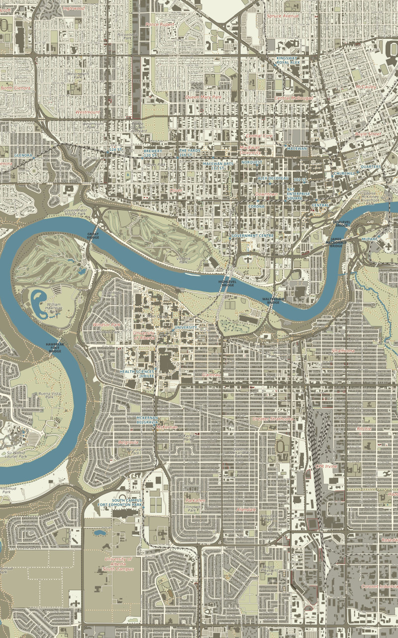 |
OpenStreetMap data is an amazing resource when you want to map urban areas at very large scales. In this case, my goal was to make a map someone could navigate around Edmonton, Alberta with. However, I had to fit the entire city (within the loop road of Anthony Henday Drive) onto a 42" wide sheet of paper. In the end this meant a scale of 1:35,000. The OSM data was very good, but I did not want to use the default OpenStreetMap colours. Fortunately, in QGIS you can readily download the OSM data for an area using the OSM Downloader plug-in, and then you can customize the styling rules. (It is all rule-based styling.) The inspiration for my colour palette was this sheet from the Second Military Survey of the Habsburg Empire (1861-1864), which I grabbed a screenshot of at arcanum.com. |
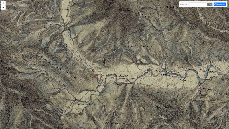 |
I loved the muted greys and greens of this pre-contour-line cartography, with the little shot of blue that is the river. (This is the area around what is today Верховина/Verkhovna, Ukraine.) Although I had my data and my colours, there was still a lot of work to do. OSM Downloader does not give you a complete copy of OSM. I had to tweak a few things to get them to display properly: railways, mosques, golf courses, light rail stations, parking lots, bike paths and parks were some of the elements I had to fiddle with. I learned a lot about the data structure of OSM! Here is the complete map, at 42" wide and 54" tall. |
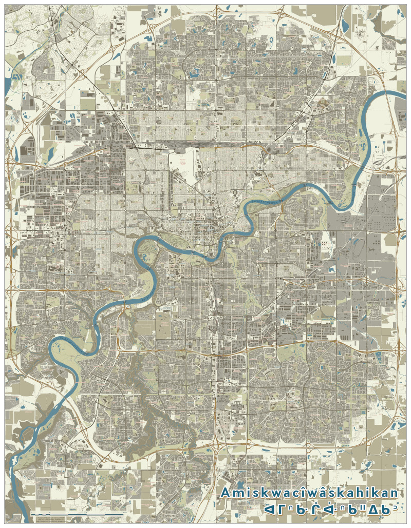 |
I learned that the North Saskatchewan River is kisiskâciwanisîpiy ᑭᓯᐢᑳᒋᐘᓂᓰᐱᐩ, meaning Swift-flowing River in Cree, so I labelled it as such. The sîpiy part means river. The vowels with the carets over them are long. There is a good Cree syllabic chart is at https://en.wikipedia.org/wiki/Western_Cree_syllabics. Similarly, Edmonton itself is amiskwacîwâskahikan (ᐊᒥᐢᑿᒌᐚᐢᑲᐦᐃᑲᐣ), meaning “Beaver Hills House," and I used this as my title. If you have access to a 42" wide printer and you want to create a hardcopy of this, let me know and I will send you the PDF file! |