 |
|
East
Boulder Creek Backcountry Ski Map
|
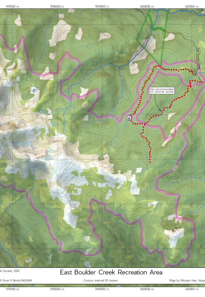 |
This is a backcountry ski map of the East Boulder Creek area, near Witset, BC, I made it for the Bulkley Backcountry Ski Society (BBSS.ca). The landcover is the vector polygons of LandCover Canada Circa 2000. Normally I display this at something like 25% opacity, but in this case I wanted to make a more saturated map, hearkening back to the styles of the 1970s, so I turned it up to 50%.
The recreation area is a polygon sent to me by the Society, along with GPS tracks for the two ski routes, and a GPS point for the winter campsite. Contour labelling is automatic. You'll find a link to it at https://bbss.ca/east-boulder-creek/. |
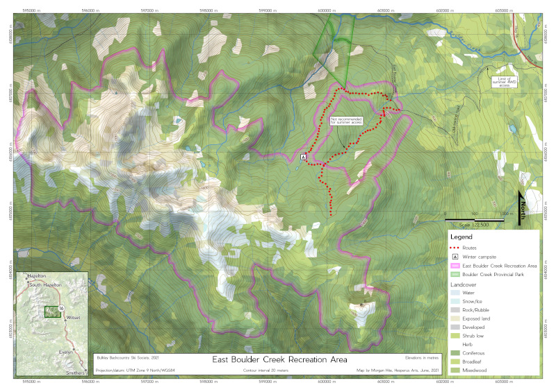 |
For the inset locator map, I could not use the Canada Basmap Transport WMS service, because it still labelled Witset with its old name, Moricetown. So instead I used a a much-faded version of the Landcover Canada, draped over a WMS hillshade from openmaps.gov.bc.ca. |