 |
|
Clearwater
Lakes trail
|
 |
| In the summer, the
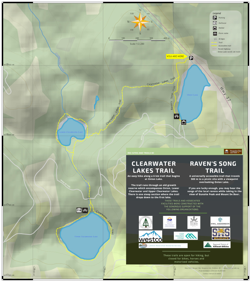
Onion Lake Nordic Ski area in Kitimat hosts the Clearwater Lakes
trail. This will be the sign at the parking lot. The scale here is an incredibly large 1:2200. I used a 10 metre contour interval, and landcover from the vector Landcover Canada Circa 2000 layer. The hillshade was created in QGIS (with the "Toolbox" hillshader) from a 1m DEM that I resampled and re-projected from a CDED 0.75" DEM. This was a new kind of title block for me. I took inspiration from Canva.com -- as if this were an infographic -- and then modified it to suit my needs. In 2022, I updated the sign to include the new accessible Raven's Song trail, and a new picnic table and shelter. Rec Sites and Trails requested that I review the map for color-blind perception, and as a result I changed the trail colour from red to yellow. Both QGIS and GIMP have some good tools for rendering an image as seen either by someone with protanopia (insenstivity to red) or deuteranopia (insensitivity to green). In QGIS, try View>Preview mode. For GIMP, try View>Display Filters…. Note that for some reason the previews in QGIS and Gimp do not really give the same results. |