 |
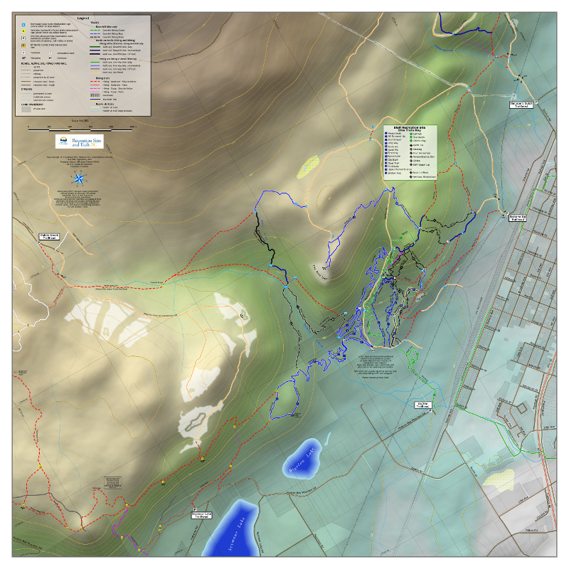 |
Ten years ago, when I was still working with MapInfo, I made some maps to be displayed on kiosks at the major trailheads near Smithers. This year I got to re-make them in QGIS! So much has changed in ten years! We have piles of mountain bike trails now, and there are eleven trailheads! As well, I no longer think an air photo makes a very nice background for a map, so I set out to do something that would be easy to read and still communicate terrain. To that end I used some shaded relief (generated in Blender, of course) plus a DEM that was hypsographically tinted. I used a colour ramp imitating the one used in those fabulous Raven maps of US states: pale blue at the low end, passing through green and up to brown and white at high end. This was all composed in QGIS and finished in Inkscape. |
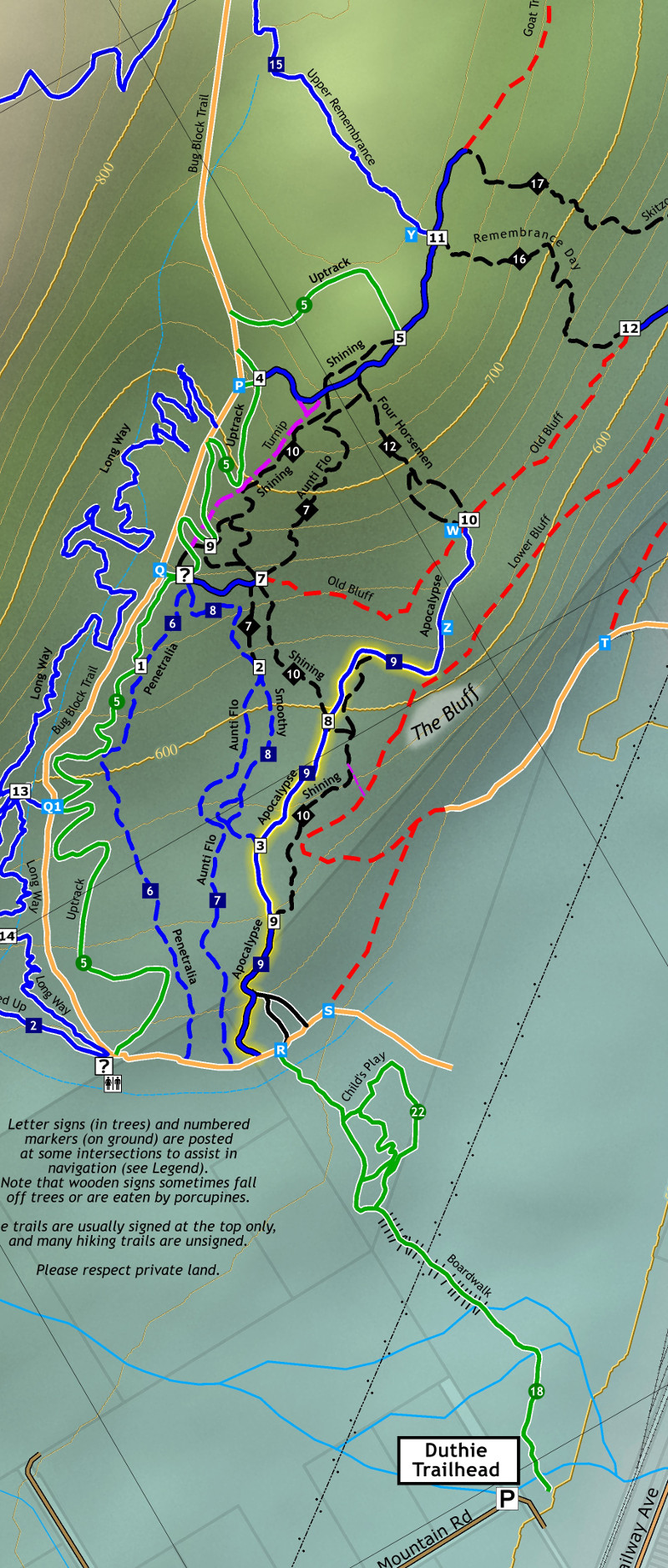 |
I also went for a kind of a "subway" map look, in that trails are mostly bounded lines -- suggesting that once you get on a trail you're on it to the next intersection. The bike trails are of course rated into difficulty levels, while the hiking trails have different considerations (moderate vs. steep, easy-to-follow vs. faint). The scale of these maps is 1:6,000, which, by my general rule, means I would need a DEM with a cell size of 60 cm to generate the shaded relief. Well, that would be nice, but I didn't have anything even remotely that good. I used the SRTM DEM, whose cell size is somewhere in the 20m range, and then resampled it down to 3m. I denoised it in GRASS, and then built my hillshade from that. It's too coarse for this scale, but it works as a general suggestion of the landforms. (Can imagine though how good a 60cm DEM would look?) One of the great things about making these maps was that I improved my trails data significantly, both through receiving GPS tracks from other people and from walking and GPSing the trails myself. |